CSD Oz Forecast
Every home has a smell that you can't smell when it's your home
CSD

MENU
Oz Forecast
Enter Town Name:
Enter Town Name:

NE NSW & SE QLD Weather Radar, Satellite and Lightning Map

Radar background
NE NSW & SE QLD Radar Overlay
Radar
Wills Road: 1.0mm (last 24 hours)Marshall Road: 1.0mm (last 24 hours)CQDAF Mobile 2: 0.5mm (last 24 hours)Boyanda North (Spring Ridge): 0.2mm (last 24 hours)Macalister: 0.2mm (last 24 hours)Kupunn (DDCGI): 0.2mm (last 24 hours)Daandine (DDCGI): 0.2mm (last 24 hours)Jimbour (DDCGI): 0.2mm (last 24 hours)Yandilla (DDCGI): 0.4mm (last 24 hours)Narratigah (Calga Hill): 0.2mm (last 24 hours)Jimbour North: 0.2mm (last 24 hours)Macalister (DDCGI): 0.2mm (last 24 hours)CSD Field Site Near Brookstead: 0.2mm (last 24 hours)CSD Field Site Near Blackwater: 17.8mm (last 24 hours)Brayland (Comet): 9.4mm (last 24 hours)Denlo Park (Fernlees): 3.6mm (last 24 hours)Goonoo (Comet): 0.8mm (last 24 hours)Currimundi (Comet): 3.6mm (last 24 hours)Wigtown (Pampas): 1.4mm (last 24 hours)Emerald: 0.4mm (last 24 hours)Rockhampton: -1.6mm (last 24 hours)Gladstone: 0.2mm (last 24 hours)Gladstone Airport: -2.6mm (last 24 hours)Blackwater Airport: 3.8mm (last 24 hours)Lochington: 12.8mm (last 24 hours)Greenbank (Defence): 1.4mm (last 24 hours)Tin Can Bay (Defence): 0.2mm (last 24 hours)Gympie: 0.2mm (last 24 hours)Brisbane Airport: 0.2mm (last 24 hours)Gold Coast Seaway: 0.2mm (last 24 hours)Coolangatta: 0.2mm (last 24 hours)Bourke: 3.6mm (last 24 hours)Girilambone: 0.6mm (last 24 hours)Thargomindah: 2.0mm (last 24 hours)Walgett: -0.2mm (last 24 hours)Coonamble: 0.2mm (last 24 hours)Coonabarabran Airport: 0.4mm (last 24 hours)Portable QFR n (Wieambilla): 0.2mm (last 24 hours)Portable NSW RFS 20 (Kingstown): 1.6mm (last 24 hours)Portable NSW RFS 12 (Tabulam): 0.2mm (last 24 hours)Hedlow Airfield Tm: 0.2mm (last 24 hours)Emerald Radar Al: 0.4mm (last 24 hours)Capella (Rowes Hill) Alert: 11.8mm (last 24 hours)Craigmore Al: 14.0mm (last 24 hours)Springsure Creek Junction Al: 4.8mm (last 24 hours)Ducabrook Al: 9.4mm (last 24 hours)Heathwood Al: 2.0mm (last 24 hours)Kulumur Range Alert: 11.0mm (last 24 hours)Westwood Tm: 0.2mm (last 24 hours)Jingle Downs Alert: 2.0mm (last 24 hours)Forestdale(Johnson Rd)Al: 2.0mm (last 24 hours)Pacific Haven Alert: 2.0mm (last 24 hours)Deception Bay Alert: 2.0mm (last 24 hours)Bellbird Park (Purser Rd) Al: 1.0mm (last 24 hours)Gympie Alert: 1.0mm (last 24 hours)Woodspring Tm: 1.6mm (last 24 hours)Glengallan Creek Alert: 2.0mm (last 24 hours)Duri (Dungowan Rd): 0.6mm (last 24 hours)Thora Post Office: 2.5mm (last 24 hours)Elands (Black Sands Creek): 0.2mm (last 24 hours)Coonabarabran (Barina -Tm): 0.8mm (last 24 hours)Beckers Tm: 3.0mm (last 24 hours)Springsure Al: 2.0mm (last 24 hours)Cowley Tm: 3.0mm (last 24 hours)Glenora Road Tm: 2.0mm (last 24 hours)Florence Vale Alert: 2.4mm (last 24 hours)Roddas Lookout Alert: 1.0mm (last 24 hours)Blackboy Creek Tm: 3.0mm (last 24 hours)Blackdown Tableland Tm: 10.0mm (last 24 hours)Mt Mayde Al: 5.0mm (last 24 hours)Green Valley Alert: 2.0mm (last 24 hours)Billaboo Al: 11.0mm (last 24 hours)Glen Rock Al: 1.0mm (last 24 hours)Echo Hills Alert: 2.0mm (last 24 hours)Upper Van Dyke Al: 1.0mm (last 24 hours)Tieri Alert: 0.4mm (last 24 hours)Humboldt Alert: 0.2mm (last 24 hours)Avocet Alert: 4.8mm (last 24 hours)Arcturus Downs Alert: 9.0mm (last 24 hours)Comet Weir Alert: 2.4mm (last 24 hours)Bedford Weir Tw Alert: 13.0mm (last 24 hours)Duckponds Alert: 7.0mm (last 24 hours)Gregory Highway Alert: 1.0mm (last 24 hours)Sapphire Al: 3.0mm (last 24 hours)Upper Belyando Tm: 3.0mm (last 24 hours)Mt Panorama Alert: 5.0mm (last 24 hours)The Crescent Alert: 2.0mm (last 24 hours)Keilambete Alert: 8.0mm (last 24 hours)Mt Ogg Alert: 6.0mm (last 24 hours)Upper Retreat Alert: 6.0mm (last 24 hours)Waikola Alert: 1.0mm (last 24 hours)Weringa Creek Alert: 2.0mm (last 24 hours)Bluff Alert: 2.0mm (last 24 hours)Cooinda Alert: 3.0mm (last 24 hours)Mt Pisgah Alert: 3.0mm (last 24 hours)Glenlee Alert: 1.0mm (last 24 hours)Serpentine Alert: 15.0mm (last 24 hours)Tarabah Tm: 1.0mm (last 24 hours)Dooloogarah Alert: 3.0mm (last 24 hours)Upper Warrego Alert: 2.0mm (last 24 hours)Jo Jo Station Alert: 4.0mm (last 24 hours)Borilla Ck Alert: 1.5mm (last 24 hours)Mt Moffatt Alert: 1.0mm (last 24 hours)Medway Alert: 17.0mm (last 24 hours)Mantuan Downs (West) Alert: 1.0mm (last 24 hours)Tanderra Alert: 2.0mm (last 24 hours)Sandstone Park Alert: 3.0mm (last 24 hours)Billabalong Alert: 6.0mm (last 24 hours)Arcadia Valley School Alert: 1.0mm (last 24 hours)Basalt Creek Alert: 10.0mm (last 24 hours)Mt Pleasant (Central Highlands) Alert: 1.0mm (last 24 hours)Darr Tm: 1.0mm (last 24 hours)Mt Calder Alert: 2.0mm (last 24 hours)Retreat Tm: 2.0mm (last 24 hours)Dykehead Tm: 1.0mm (last 24 hours)Lands End Tm: 4.0mm (last 24 hours)Cania Dam Hw Tm: 1.0mm (last 24 hours)Bindaree Tm: 6.0mm (last 24 hours)Wowan Cemetry Rd Tm: 10.0mm (last 24 hours)Alma Ck Bore Tm: 9.0mm (last 24 hours)Boolaroo Tops Tm: 24.0mm (last 24 hours)Cedar Vale Alert: 5.0mm (last 24 hours)Ned Churchward Weir Hw Alert: 2.0mm (last 24 hours)Upper Castle Alert: 5.0mm (last 24 hours)Pheasant Ck Alert: 13.0mm (last 24 hours)Wowan Westwood Rd Alert: 24.0mm (last 24 hours)Mt Fort William Alert: 2.0mm (last 24 hours)Ceratodus Alert: 2.0mm (last 24 hours)Dalgangal Rd Alert: 1.0mm (last 24 hours)Marriages Alert: 1.0mm (last 24 hours)Monal Rd Alert: 6.0mm (last 24 hours)Mt Beatrice Alert: 2.0mm (last 24 hours)Table Tops Alert: 12.0mm (last 24 hours)Bald Knob Alert: 0.4mm (last 24 hours)Boat Mountain Alert: 2.0mm (last 24 hours)Caboonbah Alert: 1.0mm (last 24 hours)Mt Mee Alert-P: 2.0mm (last 24 hours)Ferris Knob Alert: 1.0mm (last 24 hours)Tallai Alert Repeater: 32.0mm (last 24 hours)Meridan Way Al: 2.0mm (last 24 hours)Palmwoods Sportsground Alert: 1.0mm (last 24 hours)Stoney Wharf Road Alert: 2.0mm (last 24 hours)Lipscombe Rd Alert: 1.0mm (last 24 hours)Monsildale Alert: 2.0mm (last 24 hours)Borumba Dam Hw Al: 12.0mm (last 24 hours)Bellthorpe (Gap Rd) Alert: 2.0mm (last 24 hours)Reedy Creek Alert: 1.0mm (last 24 hours)Cooyar Ck Cooyar-Kooralgin Rd Tm: 2.0mm (last 24 hours)Bony Mountain Alert: 1.0mm (last 24 hours)Brigalow Bridge Alert: 0.2mm (last 24 hours)Cooks Tank Alert: 4.0mm (last 24 hours)Willara Alert: 2.0mm (last 24 hours)Palmers Road: 4.0mm (last 24 hours)Cudgera Creek (Pottsville Reservoir): 21.0mm (last 24 hours)

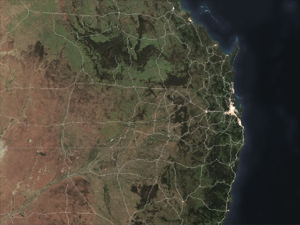
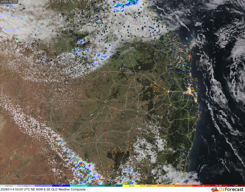
This NE NSW & SE QLD storm tracker displays the fusion of radar, satellite, bushire hotspot detections, lightning and surface observations. The background map is actual true-colour imagery from low earth orbit satellites from recent days and will update automatically. Some areas may appear grey if no recent imagery is available, e.g. due to persistent cloud cover or bushfire smoke. Detected lightning is shown by yellow lightning icons. Arrows represent wind speed and direction observations from ground-based weather stations, with red arrows showing wind gusts >65km/h, while the small coloured dots indicate weather station rainfall measurements over the previous 24 hour period, in millimetres, according to the scale at the bottom. You may hover the mouse over these coloured dots or click for additional weather information. The weather radar reflectivity data, which also follows the colour sequence legend at the bottom, is a composite from multiple Bureau of Meteorology (BOM) weather radar sites. Real-time satellite cloud imagery is originally processed by the BOM from the geostationary satellite Himawari-9 operated by the Japan Meteorological Agency. Fire hotspots detections are included from four spacecraft, courtesy of NASA and JAXA. Older hotspots will appear as orange while real-time detections will be coloured red. Less intense fires are displayed as more transparent.

This information is automatically generated, is not quality controlled and may not update in a timely manner. You accept all risks and responsibility for losses, damages, costs and other consequences resulting directly or indirectly from using this site and any information or material available from it.